What Questions Should I Ask a Land Surveyor?
Knowing the right questions to ask your land surveyor can make all the difference in your project's success. It's a crucial step in ensuring your property or development project is in capable hands. Let's discuss some key questions that will help you understand the expertise and capabilities of your land surveyor.
What Technologies and Methods Do You Use in Land Surveying?
Understanding the technology and methods a land surveyor uses is essential. It gives you insight into how advanced and accurate their services are.
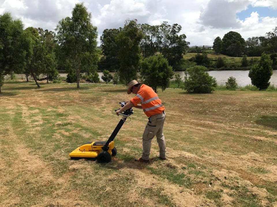
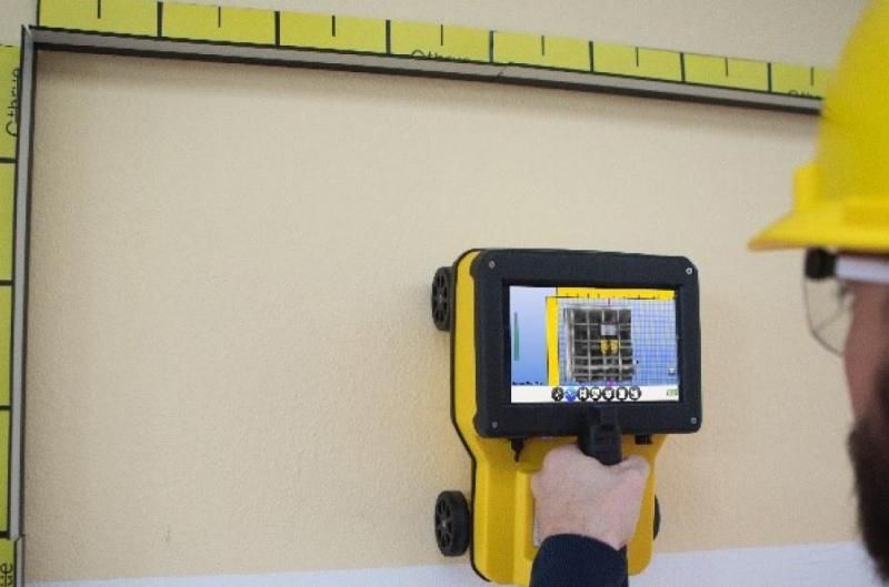
GPS/AutoCAD Drawing
Modern surveyors often use GPS technology for precise location mapping. This technology ensures high accuracy in determining coordinates, which is essential for boundary and construction surveys. AutoCAD software is also commonly used for creating detailed plans and drawings. It allows for the creation of precise, scalable drawings that can be easily shared and modified, facilitating better communication and planning between various stakeholders in a project.
Drone Surveying
Drones provide a unique perspective, allowing surveyors to capture comprehensive aerial photographs and data. This method is particularly useful in accessing hard-to-reach areas and provides a bird's-eye view, which is essential for large-scale planning and monitoring. Drone technology also speeds up the surveying process, allowing for quick data collection while maintaining high levels of accuracy and detail.
How Do You Ensure the Accuracy of Your Survey Data?
Accuracy is the cornerstone of surveying. A reliable surveyor will have a systematic approach to ensure the data's precision. They often cross-reference their findings with existing plans and use advanced technologies to validate their measurements. In addition to these methods, rigorous quality control procedures are integral to maintaining accuracy. This involves multiple checks and verifications at different stages of the surveying process.
Surveyors also stay updated with the latest surveying standards and practices, ensuring their methods meet industry benchmarks. Furthermore, they often engage in continuous professional development to keep their skills sharp and up-to-date, which is crucial in a field where precision is important. This commitment to accuracy not only enhances the reliability of their work but also builds trust with clients, ensuring the survey data can be confidently used for critical decision-making.
What Is Your Approach to Handling Unforeseen Complications?
Unpredictable challenges are part of surveying.
Problem-Solving Skills
A good surveyor must have strong problem-solving skills to address issues like obscured property lines or unexpected subsurface structures. They must also be adaptable, using their expertise to find solutions that maintain the integrity and accuracy of the survey.
Communication
Effective communication with clients and team members is key to resolving complications swiftly and efficiently. This also involves actively listening to client concerns and providing clear, regular updates on the project's progress.
What Are Your Strategies for Ensuring Compliance?
Compliance with standards and regulations is non-negotiable in surveying. The strategies may include:
- Regular Training: Continuously updating knowledge on the latest regulations, technologies and industry standards.
- Professional Certification: Maintaining up-to-date professional certifications and licences.
- Client Education: Informing clients about compliance requirements and how they impact surveying activities.
- Documentation Standards: Ensuring all surveying documents and reports meet legal and industry standards.
- Ethical Practices: Upholding ethical standards in all surveying activities to ensure integrity and public trust.
- Collaboration with Authorities: Working closely with local authorities and regulatory bodies to ensure compliance.
How Do You Document and Present Your Survey Findings?
The presentation of survey data is as important as the data collection itself.
Detailed Reporting
Surveyors should provide detailed reports that are easy to understand and use in the planning and development stages. These reports should also be comprehensive, covering all aspects of the survey in a format that is accessible to all stakeholders.
Use of Visual Aids
Maps, drawings and photographs help in visualising the survey data effectively. These visual aids are not just tools for presentation but also crucial for accurate interpretation and decision-making in various project phases.
Make Informed Decisions: Consult Our Surveyors!
Choosing the right
land surveyor
is a critical decision for your project. By asking these questions, you can ensure your surveyor is equipped with the right skills, technology and experience to meet your needs. If you're looking for reliable surveying services in
Brisbane or the
Gold Coast,
contact us at
Lambert Locations. We're committed to providing top-notch surveying solutions that cater to your unique requirements.